- Nova Scotia
- Nova Scotia Hiking
- Ingonish hiking trails
Ingonish Hiking Trails
...discover the great outdoors...
I can easily spend several days wandering Ingonish hiking trails. The variety of trails is great and the views of the ocean and the coastline are awesome.
All of these trails are in the Cape Breton Highlands National Park so you'll need to get a visitor's day pass at the entrance to the park in Ingonish Beach. The park does a good job of maintaining the trails and the informational panels at the trailheads are always useful.
The one exception is the Cape Smokey trail which is located on Cape Smokey mountain in the provincial park of the same name. Great trail with awesome views.
The VIC at the Ingonish park entrance will have maps for you. They don't have a lot of detail but they'll show you where the hikes are located in the park. The panels at the trailhead will give you more information on the specific hike.
Don't forget to get the FREE map of the park at the VIC.....it is extremely useful! I have included 3 links to portions of the Parks Canada map that will give you a good idea of the area.
Neil's Harbour area, Broad Cove and Ingonish Beach. These will be helpful as you read through my trail descriptions below. I have included them because I think they'll give you a good sense of where all the trails are located.
Ingonish is a full service community with accommodations, campgrounds, restaurants, banks, Nova Scotia Liquor Commission, and grocery stores. And don't forget to check out the fabulous Ingonish beaches.
Cape Breton Hiking Tip
One thing that I learned a long time along about hiking in Cape Breton is not to let the weather stop you!! Even if it is rainy in the morning.......go anyway! Just be prepared, have everything you need and enjoy the experience.....even if it is in the rain!
I have listed the hikes in 3 categories:
- Coastal hikes
- Challenging hikes with great ocean views
- Short trails
I have also added a link at the end of the page to a hike to an old abandon cold mine along the Clyburn River.
These are all great hikes and I hope that you will find one that suits your needs and wants. Remember to let me know about your Ingonish hiking adventure in the form at the end of the page. You’ll get your page right here on Your-Nova-Scotia-Holiday.com.
Happy Hiking!!
Coastal Hikes
The Coastal (#16 on the park map)
11.3 km (7 mi); return; elevation is 0-45 m (0-150 ft); 3-4 hours
Moderate
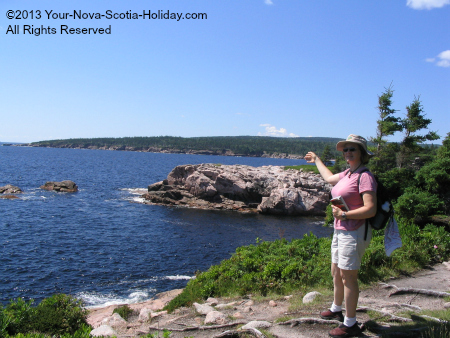
This trail is definitely one of the best in Nova Scotia if you like hiking along the Atlantic Ocean coastline. I never get bored of this trail.
I'll call it moderate level because it has some well defined trail sections but there are also many parts on the huge rocks hugging the coastline. So close that you'll feel the ocean spray on your face.
The coastline trail has 2 trailheads: at Black Brook (next to the beach of the same name) and Halfway Brook which is close to the fishing village of Neil's Harbour. Looks for the signs on the Cabot Trail and you’ll see it.
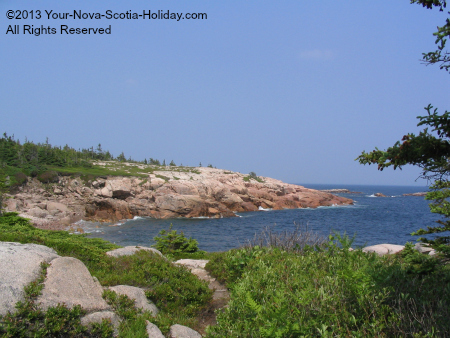
The Jack Pine Trail & Jigging Cove Trails also connect to the coastal. These trails are more inland but are very nice detours off the coastal.
Most of the coastal hike is along the huge rocks that hug the coastline. However, there are some sections that will take you closer to the tree line. There are markers but are sometimes hard to see.
Coastal Trail hiking tip:
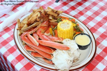
Be sure to go to the Chowder House in Neil's Harbour afterward for a bite to eat. This place is next to the Lighthouse and is basically on the cliff. I always get crab when I go there and it is A+ after a hike.
Turn right on the Cabot Trail when you leave the trailhead parking lot. You'll see the signs for Neil's Harbour......follow the road toward the lighthouse and it will take you to the Chowder House.
Jack Pine (#15 on the park map)
2.3 km (1.4 mi); loop; elevation is 10-55 m (35-180 ft); 1 hour
Easy to Moderate
This scenic trail overlooks the Atlantic coastline and winds through a post-fire jack pine stand. This pocket of jack pine is significant because it is separated from the rest of its range by 200 km.
Interpretive panels tell the story of this area, beginning with a fire in 1921, a budworm infestation and the hardy vegetation that survives today in this harsh coastal environment. If you want a longer hike, connect up with the Coastal Trail (#16).
Jigging Cove Lake & Brook (#17 on the park map)
5 km (3.1 mi); return; elevation is 0-65 m (0-215 ft); 2-3 hours
Easy to Moderate
Birders and other nature lovers simply enjoy the varied wildlife on this short relaxing level trail, following the shoreline of a small man-made lake before connecting with Coastal Trail.
The trail name comes from a neighbouring cove, where fishermen used to jig for cod. The trail can have wet sections so make sure you have good footwear.
Challenging Climbs &
Great Ocean Views
Franey Mountain (#22 on the park map)
7.4 km (4.6 mi); loop; elevation is 95-430 m (310 - 1410 ft); 2-3 hours
Moderate to Difficult
If you are up for a challenge the climb to Franey Mountain is a great choice. The reward at the top is worth it!! There are lots of wooden stairs along the way to help out. I am actually not sure if they help or not.
I have a specific page just for Franey.
Remember to stop and turn around as you climb. You'll start to see parts of the view and it will encourage you to keep going. The view from the top of Franey is awesome!
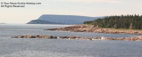
You'll have a clear view of the open Atlantic Ocean, Middle Head, Cape Smokey, Ingonish Island, the Clyburn River. Look north (to your left) and on a clear day you might see St. Paul's Island.
You can descend Franey and complete the loop by taking the fire access road. This is easier on the knees than returning on the trail you climbed.
Broad Cove Mountain (#19 on the park map)
2.3 km (1.4 mi); return; elevation 35-180m (115-590 ft); 1 hour
MODERATE
This is another steep climb not just as long as Franey. The views are once again fantastic and worth the climb. You can walk to the trailhead if you are camping at the Broad Cove campground.
Branch Pond Look-Off (#21 on the park map)
14 km (8.1 mi) return; elevation is 100-305 m (330-1000 ft); 4-5 hours
MODERATE to DIFFICULT
This is a steady climb and only to be taken by experienced hikers because of the elevation change and the time required to complete the hike. You will climb through boreal forest and onto the highland plateau.
Great views of the plateau and the ocean await you.
Cape Smokey trail (located on Cape Smokey mountain)
11 km (6.2mi) return; elevation varies; 3-4 hours
MODERATE
A fantastic hike with breathtaking views of the Atlantic ocean coastline as well as South Bay and North Bay Ingonish and the Middle Head Peninsula
Short Trails
Middle Head (#24 on the park map)
3.8 km (2.4mi); loop; elevation is 0-45 m (0-150 ft); 1 - 1.5 hours
EASY
I like to think of Middlehead as a nice trail to do early in the morning or after an early evening meal. It is not a difficult trail and is suitable for almost everyone. It leads out to Middle Head which separates North and South Bay Ingonish.
To the south you'll see views of Ingonish beach and Cape Smokey. To the north is Ingonish Island, Neil's Harbour and on a clear day St. Paul's Island.
The trail starts behind the Keltic Lodge and you can park in their parking area.
Green Cove (#18 on the park map)
.2 km (.2mi); return; elevation is 10 m (35 ft); 10 minutes
VERY EASY
I really wouldn't consider this is a hiking trail. It is a look-off on the Cabot Trail. This is an awesome spot to get close to the ocean and feel the ocean air on your skin.
It is a rocky headland jutting out from the cliffs. You'll see lots of waves crashing on the rocks. This is a perfect place to stop if you aren’t very mobile and have trouble walking.
Warren Lake (#20 on the park map)
4.7 km (2.9 mi); loop; elevation is 15 m (50 ft); 1.5 hours
VERY EASY
This is another easy level hiking trail. It is a loop around Warren Lake where there is also a beach. Some folks might prefer swimming here since it is considerably warmer than the cold Atlantic Ocean.
The hike is very relaxing and is a good one to get the kids out into the woods. This one is also good for folks who might have trouble walking and not be able to do some of the other hikes in the park.
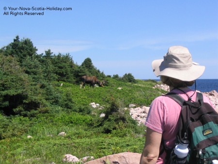
You might even see some moose......anything is possible on a hike like this.
Freshwater Lake (#26 on the park map)
1.7 km (1.1 mi); loop; elevation is 0-15 m (0-50 ft); 30-40 minutes
VERY EASY
This is an easy relaxing hike and a great one to do while spending the day at Ingonish Beach. The trailhead is near the canteen area on the beach so it should be easy to find.
There is actually a section along the top of beach before it takes you to the lake. There are a couple of viewing decks around the lake. This is a wheelchair accessible trail and is very well maintained.
Bicycles are also permitted on this trail so be careful.
Freshwater Lake Look-off (#25 on the park map)
.3 km (.2 mi); return; elevation is 10-45 m (35-150 ft); 10 minutes
EASY but STEEP
This is a short but steep hike with a great view at the top. It is directly across from the Visitor Information Centre at the entrance to the park in Ingonish Beach.
We did this one quickly one day after walking around Freshwater Lake. It might be steep but it is great if you want to quickly get a cardio work-out. I loved it and would seriously recommend to everyone especially if you don't have a lot of time for a longer hike.
This might also be a good hike for children who like the woods and have lots of energy. Watch them at the top since you have just made a climb and there is a look off area. The view might be enough to hook them into hiking as a regular activity.
Hike to an abandoned Gold Mine
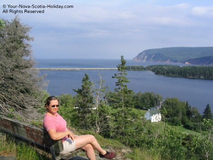
This is a hike for exploring!! Go to my page about the Clyburn Valley hike and find the remains of an old abandoned gold mine!
- Nova Scotia
- Nova Scotia Hiking
- Ingonish hiking trails
Have you hiked trails
in the Ingonish area?
Do you have a great story about it? Please share it with us!
Please share this page with your friends.
