- Nova Scotia
- Nova Scotia Hiking
- Money Point Trail
Explore the Money Point Trail
in Northern Cape Breton
I call the Money Point trail ‘The Hiking Trail at the end of the World’ because this is how I felt when I did it several years ago.
It was a beautiful sunny day and I knew that I was hiking to the tip of Cape Breton BUT the feeling that I had when I arrived was really special! This is Nova Scotia hiking at its best!
I felt like I was exploring a very remote part of the island where few go and where few wish to go. The fact that I wanted to be there and to experience this remoteness made me feel closer to the inner core of Cape Breton!
Why is it called the Money Point Trail?
This is a good question! Apparently, many moons ago, a ship was lost near here that was carrying the pay for the garrison in Quebec. For years following the wreck, gold and silver coins were found along the shore.
Before you go to Money Point
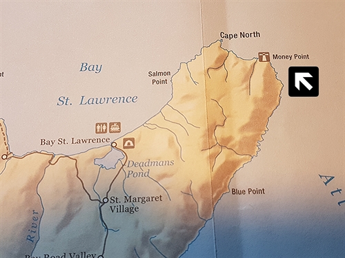
Directions: Take the exit to Bay St. Lawrence off the Cabot Trail in Cape North. Bay St. Lawrence is about 16 km (10 mi) from Cape North. Once you reach the village, follow the Money Pont Road until it ends and park your car to the side. You will see the Money Point trail to your right.
Make sure you tell someone that you are doing this hike and your expected time of return. Check in with them when you do return.
GPS at trailhead: N 47o 00' 46.5" W 60o 26' 24.7"
Distance: The trail is about 16-km (10 mi) return.
Time: About 5-7 hours to complete the hike. Add another hour if you plan to hike to the new lighthouse which is located north of Money Point.
Level of Difficulty: Moderate to difficult; very steep; not recommended for people who have trouble walking or for children. This is a long hike!
Food/Water: Lots of water and a lunch are a must!
Clothes: A sweater or light jacket as it will be cool once you reach Money Point; a hat and walking stick; sturdy walking shoes or hiking boots; insect repellent.
Facilities: There are no facilities on this trail.
Let’s get hiking
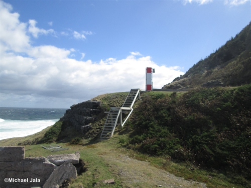
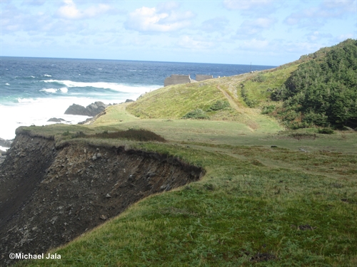
The trail you will follow was opened in order to have access to the lighthouse at Money Point when families lived there. The trail is very wide. However, the walking can be quite rough since there are a lot of large rocks along the path.
The Money Point trail is also very steep. Remember, you are climbing the side of a mountain!
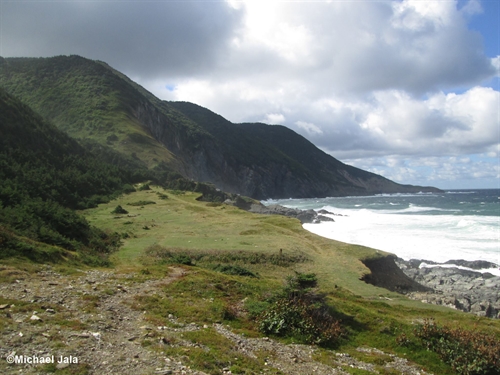
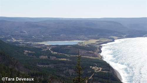
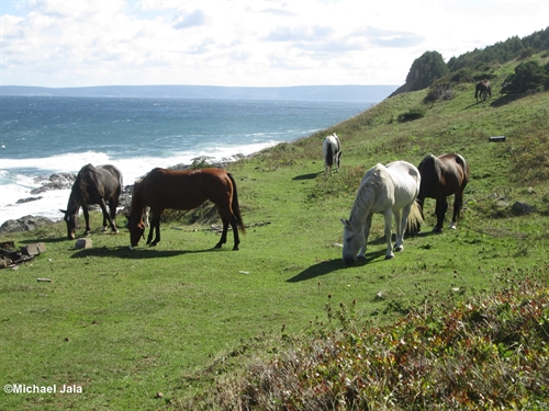
As you climb, take the time to turn around to see the view behind you. The view of the ocean and Bay St. Lawrence is spectacular. We had sun and cloud when we did this hike.
The view of Bay St. Lawrence was marked with gigantic moving shadows when I did the hike. This is what is awesome about the Money Point Trail.
It took us approximately 45 minutes to reach the top and another 30 minutes to walk across the plateau. Soon we could see the Atlantic Ocean and St. Paul’s Island on the other side.
St. Paul’s Island is approximately 14-km (8.5 mi) off shore and is a beautiful site on a clear day. Many ships have been lost here and it is generally known as the Graveyard of the Gulf of St. Lawrence.
Walking down the mountain proved to be very difficult on the knees; so I strongly suggest that you take a hiking stick for extra support.
The descent towards Money Point took about 40 minutes. We were certainly starting to feel the need for our lunch!
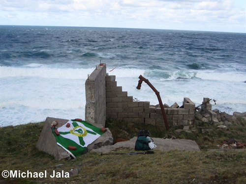
The foundation ruins of the old buildings were our picnic spot. We found ourselves in a wide open field and, despite the bright sun, it was quite windy and cool.
The foundation offered us some protection from the elements. Stop for a minute during your lunch to ponder what it must have been like to live here.
The supply boat would come only twice a year!
I remember speaking with a gentleman from Bay St. Lawrence about Money Point. He had grown up there since his Dad was the Lighthouse Keeper. He remembered one year when the supply ship did visit it has delivered all of their Christmas goodies.
Apparently, there had been a misunderstanding with the order and many more goodies were delivered than had been actually ordered. The parents were not very happy but the kids sure were!!
After we enjoyed our well-deserved lunch, we started to explore the area. We saw the rusted remains of a shipwreck. The cliffs were quite steep so a view and picture from afar was as close as we could get.
The Money Point Trail is a fantastic day hike. It is challenging but the feeling you will have overlooking the ocean and St. Paul’s Island will bring you to your knees. It is truly the hiking trail at the end of the world!
You can return to Bay St. Lawrence on the same route. It took us about 2 hours to get back to our car.
Have you hiked the Money Point trail? I would love to have a story from you to add to this page and especially more photos!! The link is below....I am waiting to hear from you!!
Accommodations
Cape Breton has a vast array of accommodations. From high-end hotels, to a Bed & Breakfast, to hostels and cottages. You will certainly find something here. Ingonish and Cheticamp have many options and are on the Cabot Trail where you'll find yourself once you leave Money Point.
What next?
Lots of activities to explore now that you are in Cape Breton. Especially northern Cape Breton! Do you like whales? Ever been whale watching? Check out my whale watching page to see where you can book a tour in northern Cape Breton.
Northern Cape Breton is also known for its many hiking trails. If you want to explore more now that you have seen Money Point there certainly are many options.
You are also not far from the Cabot Trail. You actually would have driven on the Cabot Tail to get to Money Trail. One of the most scenic drives in North America, there is lots to explore on the Cabot Trail.
- Nova Scotia
- Nova Scotia Hiking
- Money Point Trail
Have you hiked to Money Point?
Do you have a great story about it? Please share it with us!
What Other Folks Have Said
Click below to see contributions from other visitors to this page...
Familiar Territory! 


It was so great to read about your trip to Money Point. This place holds a place in my heart because I spent many an hour there as a kid.
The head …
Please share this page with your friends.
